![]()
![]()
![]()
![]()
![]()
![]()
Let Your Next Irrigation Project Take Wings with Aerial Surveys By De Villiers Visser
18 Mar 2021
De Villiers Visser Irrigation / Besproeiing was established 27 years ago by De Villiers Visser, Div and his wife. The company is headquartered in pictures que Franschhoek in the Western Cape, operating in the Western Cape, nationwide and also in neighbouring countries in Southern Africa.
The company began with garden and landscape irrigation installations and then expanded to include agricultural irrigation systems. There would, however, be many more innovations and expansions over the years. De Villiers Visser Irrigation offers irrigation designs of various systems and the company has four installation teams in the field.
Passion for aerial surveying
Div, a SABI member, tells SABI magazine on a visit to his offices in Franschhoek: “We also offer borehole pump installations and testing of boreholes. We currently have three test pump sets, from 130m3/h - 1m3/h, with 100, 30 and 20 kVA generators.”
However, it is in the combination of irrigation expertise and aerial survey technologies that really has taken De Villiers Visser Irrigation to new heights and this was the primary focus of our visit to De Villiers Visser Irrigation for our technology and survey feature in this edition of SABI magazine.
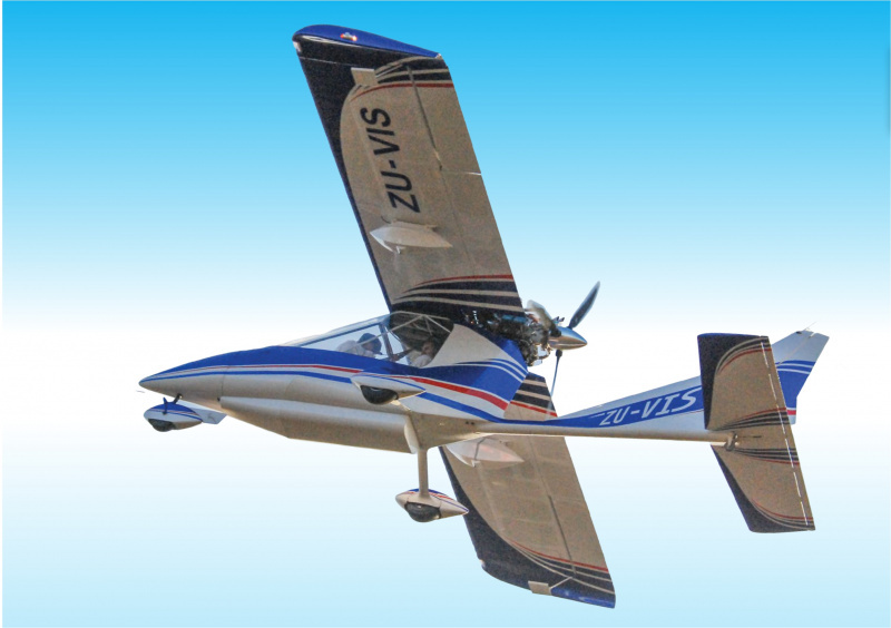
Over the years, pilot and aviation enthusiast, Div, who pilots his own aircraft, has mastered the science of conducting aerial surveys of irrigation areas. Div has acquired much knowledge and experience over the last 10 years in aerial surveys and the high-tech camera and software technologies.
Very large areas surveyed fast
Div is able to survey huge areas, rapidly and very accurately. Consider this example of an aerial survey Div conducted recently:
“Take off early morning from base, Stellenbosch airport. Land in Port Elizabeth. Activate system and take off for Kirkwood. Fly, measure the area of 1,000ha and land at Plettenberg Bay. Turn off system, fill up with fuel and land at Stellenbosch: 17h30.
” Div can easily survey 5 000 ha in a day, anywhere in South Africa and neighbouring countries. It certainly gives new high-flying meaning to the adage “as jy meet jy weet”! Many irrigation and agricultural groups have already utilised the company’s surveying services– due to Div offering exceptionally
speedy delivery with high quality and accuracy.
Accuracy
It’s a clear advantage that Div, a fellow irrigation specialist and SABI member, is the pilot and conducts the surveys. Div, as an irrigation designer and business owner, is aware of the high levels of accuracy that fellow irrigation specialists require in their surveys.
Div notes that aerial surveys are naturally much more accurate and comprehensive than ground-level (using quad bikes for example) surveys, and much faster in all respects than most technologies.
“I am able to deliver surveys rapidly to my clients, which are highly accurate and offer comprehensive information and data, suited to irrigation designers’ requirements.”
NDVI processing
All aerial imagery undergoes rigorous pre-processing to allow further analysis. Once pre-processed, the visual and near-infrared wavelengths caught by the sensor are transformed using an algorithm to produce Normalised Difference Vegetation Index (NDVI) images. NDVI is one of the most successful remote sensing tools to easily and quickly assess plant and crop health as it sees things that the human eye cannot.
The NDVI images are finally converted to simple maps depending on the end-users viewing preferences. The NDVI images are displayed using pseudo-colour to help users best understand the data.
Training in Switzerland, Germany
Irrigation companies, professional land surveyors, farmers, academics, engineers and government/municipal departments seeking excellent aerial surveys can rest assured they are in good hands. Div, notably, also
completed training in Switzerland and Germany in aerial survey methodologies and the systems and software he utilises. All relevant aviation certificates and licenses are also in place, says Div
.
For more information and costs please feel free to contact
Div Visser:
+27 (0) 82 550 8694
Let your next irrigation project take wings with aerial surveys by De Villiers Visser
System details:
Specification of aerial camera / IMU/ Gimbal system: -
- Light aircraft with Gimbal that automatically stabilizes camera and IMU in “Pitch, Roll and Yaw”.
- A Phase One Industrial Camera, iXM-RS150F, 150MP. With a 90mm lens. It produces a very high-quality RAW photo. When converted to TIF each photo is 450Mb.
Post processing and delivery:
- Pix4d Mapper Photogrammetry software processes these photos into a highly accurate DTM and high-quality orthorectified Mosaic (ECW) to incorporate into Model Maker or CAD programs as background, in order to plan and design irrigation layout and design.
- Novatel SPAN/CPT IMU and Novatel Connect software provides highly accurate position and rotational angle of each photo taken in flight.
- Div delivers XYZ Grid file from DTM to generate contours in Model Maker. Also delivers a Model Maker (.mal) file at 1m contour intervals. Also provides contours in.shp, .dxf for other CAD programs.
- The othomosaic is also retracted into Google Earth for the designer’s client to use the high resolution (2-5cm / pixel or a survey point, X, Y, Z on the ground every 2x2m - 5x5m.) De Villiers Visser Projects:
De Villiers Visser Besproeiing/Irrigation Projects:
Clients include professional surveyors, farmers and irrigation companies in South Africa (nationwide) and neighbouring countries (Mozambique, Swaziland and Namibia).
For other agricultural products and services, click here.
Credit to SABI Magazine
Share this article


Popular Posts

01 Mar 2023

07 Feb 2023


28 Nov 2022

19 Oct 2022

12 Sep 2022
Archived Posts
2024 (1)
July (9)
June (6)
May (11)
April (14)
March (10)
February (12)
January (7)
2023 (1)
December (13)
November (13)
October (11)
September (15)
August (18)
July (14)
June (20)
May (22)
April (13)
March (23)
February (18)
January (13)
2022 (1)
December (16)
November (12)
October (16)
September (9)
August (25)
July (20)
June (15)
May (18)
April (13)
March (16)
February (14)
January (12)
2021 (1)
December (13)
November (9)
October (18)
September (22)
August (13)
July (13)
June (13)
May (14)
April (11)
March (13)
February (8)
January (9)
2020 (1)
December (9)
November (1)
October (9)
September (11)
August (9)
July (7)
June (15)
May (21)
April (21)
March (13)
February (10)
January (10)
2019 (1)
December (10)
November (10)
October (13)
September (6)
August (5)
June (4)
May (5)
April (4)
March (4)
February (4)
2018 (1)
December (2)
November (5)
October (4)
September (4)
August (6)
July (4)
June (4)
May (5)
April (4)
March (5)
February (4)
2017 (1)
December (4)
November (5)
October (4)
September (4)
August (5)
July (4)
June (4)
May (4)
April (2)